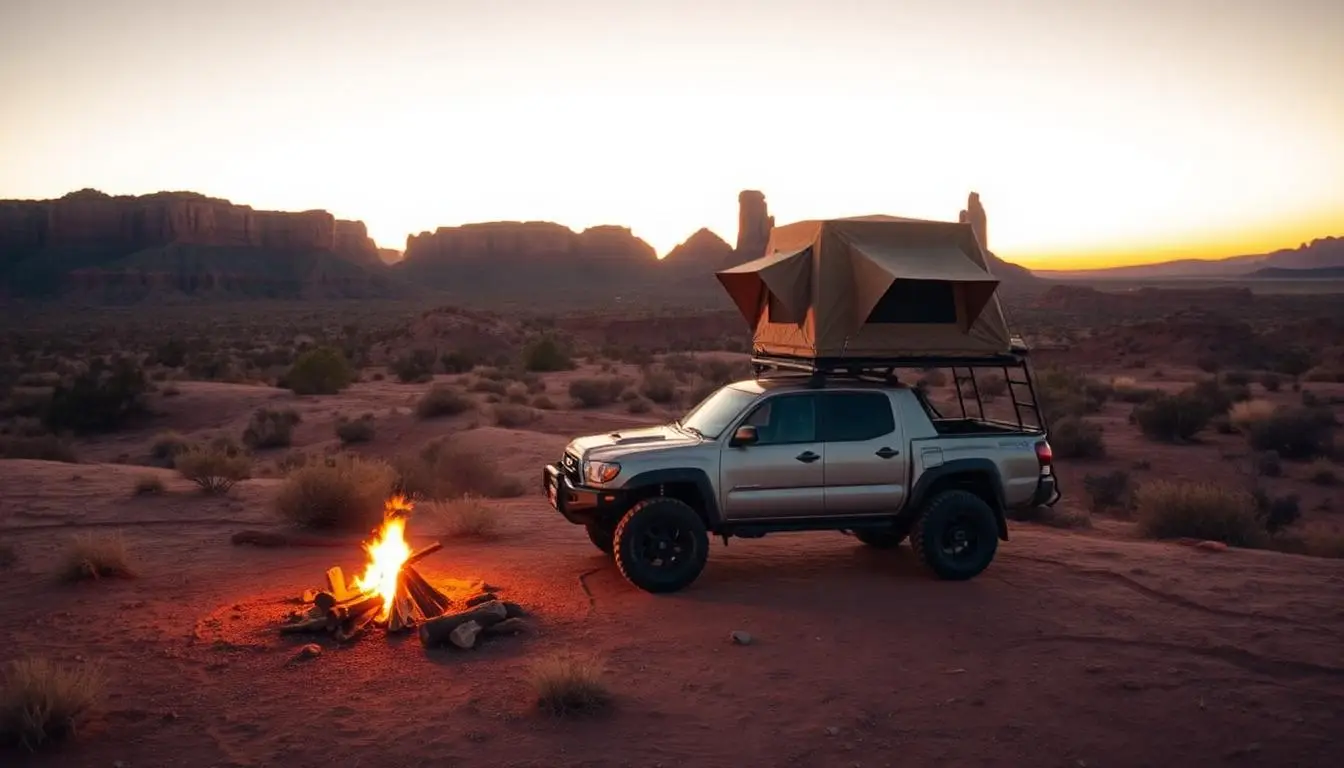
Finding a great campground is easy. Finding a great campground within striking distance of serious off-road trails, with the right access, the right terrain, and the right setup for a rig that's taller, wider, and dirtier than the average family sedan, is a different challenge entirely.
This directory exists to solve that problem. We've compiled the most comprehensive list of campgrounds, off-road parks with camping, dispersed camping areas, and overlanding base camps near major 4x4 trail systems across the United States. Every entry includes what you need to plan: camping type, approximate cost, nearby trails, vehicle access notes, and seasonal considerations.
Whether you're looking for a developed campground with hookups near Moab, free dispersed camping along the Mojave Road, or an on-site cabin at an East Coast off-road park, it's here. Also check out our full campground directory with 7,000+ searchable listings.
Bookmark this page. We update it quarterly.
How to Use This Directory
Each campground entry follows a consistent format:
- Name - The campground or camping area
- Location - State, nearest town, and managing agency
- Type - Developed campground, dispersed/primitive, or off-road park camping
- Cost - Approximate nightly fee (free for dispersed BLM/USFS unless noted)
- Reservations - Required, recommended, or first-come-first-served
- Nearby Trails - The off-road trail systems within a reasonable drive
- Vehicle Notes - Access road conditions, rig size limitations, or 4WD requirements
- Season - When the campground or area is accessible
California
California offers more variety of 4x4-accessible camping than any other state, from high-desert BLM land to Sierra Nevada forest camps to coastal dunes.
Johnson Valley OHV Area (Hammer Trails)
- Location: San Bernardino County, near Lucerne Valley. BLM-managed.
- Type: Dispersed camping on open BLM land.
- Cost: Free.
- Reservations: None needed. First-come, camp-anywhere within permitted areas.
- Nearby Trails: Hammer Trails (Ultra4, Chocolate Thunder, Wrecking Ball, Backdoor), Means Dry Lake, and surrounding BLM desert routes.
- Vehicle Notes: Any vehicle can access the main staging areas via paved roads. Trails themselves require serious 4WD builds.
- Season: Year-round, but the OHV area closes during military training periods. King of the Hammers takes place every February. Summer temperatures exceed 110 degrees F.
Rubicon Trail - Loon Lake & Wentworth Springs
- Location: El Dorado National Forest, near Georgetown. USFS-managed.
- Type: Developed campground (Loon Lake) and dispersed camping along the trail.
- Cost: Loon Lake Campground ~$30/night. Dispersed camping along the Rubicon is free.
- Reservations: Loon Lake: recommended, available via Recreation.gov. Dispersed: first-come.
- Nearby Trails: The Rubicon Trail (22 miles, the most iconic off-road trail in the U.S.), plus additional El Dorado and Tahoe National Forest routes.
- Vehicle Notes: Loon Lake is accessible by 2WD. The Rubicon Trail itself requires serious 4WD with high clearance, skid plates, and lockers.
- Season: Typically accessible June through October. Snow closes the trail in winter.
Anza-Borrego Desert State Park
- Location: San Diego County, near Borrego Springs. California State Parks.
- Type: Developed campgrounds and open dispersed camping throughout the park.
- Cost: Developed sites ~$25-35/night. Dispersed camping on dirt roads is free.
- Reservations: Developed sites: recommended. Dispersed: first-come.
- Nearby Trails: Coyote Canyon, Canyon Sin Nombre, Truckhaven Hills, Oriflamme Canyon, Fish Creek Wash, and hundreds of miles of 4WD desert routes.
- Vehicle Notes: Many trails require high clearance and 4WD. Some areas are sandy wash routes that benefit from airing down.
- Season: Best October through April. Summer temperatures routinely exceed 110 degrees F.
Big Bear / San Bernardino National Forest
- Location: San Bernardino County, near Big Bear Lake. USFS-managed.
- Type: Developed campgrounds and OHV staging areas with camping.
- Cost: $25-40/night at developed sites. Dispersed camping free in designated areas.
- Reservations: Recommended for peak summer and holiday weekends.
- Nearby Trails: John Bull Trail, Holcomb Valley, Gold Mountain, 2N10, Burns Canyon, and the Pinnacles OHV area.
- Vehicle Notes: Most campgrounds are accessible by 2WD. Trail access varies. John Bull and the more technical routes require high clearance and 4WD.
- Season: Year-round at lower elevations. Higher-elevation campgrounds typically open May through October.
Death Valley National Park
- Location: Inyo County. National Park Service.
- Type: Developed campgrounds and backcountry camping accessible by 4WD.
- Cost: Developed sites $16-22/night. Backcountry camping is free with self-registration.
- Reservations: Furnace Creek: reservations recommended. Most others: first-come.
- Nearby Trails: Titus Canyon, Racetrack Road, Lippincott Grade, Echo Canyon, Mengel Pass, Steel Pass, and dozens of backcountry 4WD routes.
- Vehicle Notes: Many of Death Valley's most iconic routes require high clearance 4WD. Titus Canyon and Racetrack Road are accessible to stock SUVs in good conditions.
- Season: October through April for comfortable camping. Summer is extremely dangerous, temperatures regularly exceed 120 degrees F.
Mojave Road / Mojave National Preserve
- Location: San Bernardino County, between Barstow and Needles. BLM and NPS.
- Type: Dispersed camping along the 138-mile Mojave Road route. Developed campgrounds at Mid Hills and Hole-in-the-Wall.
- Cost: Developed sites ~$12/night. Dispersed camping along the route is free.
- Reservations: None needed for dispersed. Developed campgrounds are first-come.
- Nearby Trails: The Mojave Road itself (a 138-mile historic 4WD route), plus surrounding BLM desert routes, Kelso Dunes, and Cima Road.
- Vehicle Notes: Manageable for most stock 4WD vehicles with adequate ground clearance, though deep sand sections near Soda Lake can be challenging. Bring extra fuel. No services for the entire 138-mile route.
- Season: Best October through April.
Los Padres National Forest
- Location: Multiple counties spanning from Monterey to Ventura. USFS-managed.
- Type: Mix of developed campgrounds and dispersed 4x4-accessible primitive camps.
- Cost: Developed sites $20-35/night. Many primitive sites are free.
- Reservations: Vary by campground. Many are first-come.
- Nearby Trails: Tecuya Ridge, Quatal Canyon, Cherry Creek, Lockwood Valley, and the extensive network of forest service roads.
- Vehicle Notes: Some of the most 4x4-accessible camping in Southern California. Several campgrounds are accessible only by dirt road.
- Season: Year-round at lower elevations. Some high-elevation roads close in winter or during fire season.
Imperial Sand Dunes (Glamis)
- Location: Imperial County, near Brawley. BLM-managed.
- Type: Dispersed camping throughout the dune system.
- Cost: Free during off-season. Season pass required October-April (~$150/season or $35/week).
- Reservations: None needed.
- Nearby Trails: The dune system itself, over 40 miles of open sand dunes for OHV use.
- Vehicle Notes: Sand-specific preparation required: paddle tires, flag whips, and lowered tire pressure. Full-size 4x4s can access the periphery.
- Season: October through April is prime season. Summer temperatures are extreme.
Utah
Utah is the undisputed capital of off-road culture, and the camping infrastructure reflects it, from developed campgrounds near Moab to remote backcountry permits in Canyonlands.
Moab Area - BLM Dispersed Camping
- Location: Grand County, surrounding Moab. BLM-managed.
- Type: Designated dispersed camping areas along Highway 313, Highway 128, and Sand Flats Road.
- Cost: Most designated dispersed sites are $15-20/night.
- Reservations: Some areas require reservations via Recreation.gov during peak season (March-May, September-October). Others are first-come.
- Nearby Trails: Hells Revenge, Fins and Things, Slickrock, Poison Spider Mesa, Golden Spike, Metal Masher, Moab Rim, Chicken Corners, and 30+ designated OHV trails.
- Vehicle Notes: Most dispersed camping areas are accessible by 2WD on maintained gravel roads.
- Season: Year-round, but spring (March-May) and fall (September-October) are ideal. Summer is hot (100 degrees F+).
Moab Area - Developed Campgrounds & RV Parks
- Location: Grand County, in and around the town of Moab.
- Type: Private RV parks and campgrounds.
- Cost: $35-80/night depending on amenities.
- Reservations: Strongly recommended during Easter Jeep Safari (late March/April) and spring/fall peak weekends.
- Nearby Trails: Same Moab trail system as above.
- Vehicle Notes: All developed campgrounds are on paved roads. Full hookup RV sites available.
- Season: Year-round.
White Rim Road - Canyonlands National Park
- Location: Canyonlands National Park, Island in the Sky District. NPS-managed.
- Type: Designated backcountry campsites along the 100-mile White Rim Road.
- Cost: Backcountry permit required, $40 per group.
- Reservations: Required. Book through Recreation.gov. Permits sell out months in advance for popular dates.
- Nearby Trails: The White Rim Road itself is a 100-mile 4WD route through Canyonlands. The Shafer Trail descent is the access road and is a trail experience in itself.
- Vehicle Notes: High clearance 4WD required. Manageable for stock 4WD trucks in dry conditions. Not recommended for vehicles over 21 feet or with trailers.
- Season: Spring and fall are best. Summer is extremely hot.
Sand Hollow State Park
- Location: Washington County, near Hurricane. Utah State Parks.
- Type: Developed campground and OHV-accessible sand dunes/slickrock.
- Cost: $20-40/night.
- Reservations: Available and recommended for weekends.
- Nearby Trails: Sand Hollow OHV area (sand dunes and slickrock), plus proximity to the Hurricane and St. George trail systems.
- Vehicle Notes: Campground accessible by 2WD. The OHV area includes sand dunes and slickrock.
- Season: Year-round.
Colorado
Colorado's high-altitude trails come with high-altitude camping, and seasonal access windows that demand planning.
Ouray / Silverton / Telluride Area - Dispersed USFS Camping
- Location: San Juan Mountains, San Juan National Forest. USFS-managed.
- Type: Dispersed camping along forest roads and at designated primitive sites.
- Cost: Free in most dispersed areas. Some developed campgrounds $20-30/night.
- Reservations: Developed campgrounds via Recreation.gov. Dispersed is first-come.
- Nearby Trails: Black Bear Pass, Engineer Pass, Cinnamon Pass, Imogene Pass, Ophir Pass, California Gulch, Poughkeepsie Gulch, and the full Alpine Loop.
- Vehicle Notes: Access roads to many dispersed camping areas require high clearance. Some campsites are only accessible by 4WD.
- Season: Typically July through September. Snow closes high passes as early as mid-September.
Warning
Molas Lake Campground
- Location: San Juan County, between Silverton and Durango on US-550. Privately operated.
- Type: Developed campground at 10,515 feet elevation.
- Cost: ~$30-50/night.
- Reservations: Recommended.
- Nearby Trails: Engineer Pass, Cinnamon Pass, Stony Pass, and the broader San Juan Mountain trail network.
- Vehicle Notes: Accessible by 2WD on US-550. Popular staging area for San Juan alpine trail runs.
- Season: Typically late May through mid-October.
Great Sand Dunes National Park / Medano Pass
- Location: Saguache and Alamosa Counties. NPS and USFS-managed.
- Type: Developed campground (Pinon Flats) and dispersed camping along Medano Pass Primitive Road.
- Cost: Pinon Flats ~$20/night. Dispersed along Medano Pass is free.
- Reservations: Pinon Flats via Recreation.gov. Dispersed is first-come.
- Nearby Trails: Medano Pass Primitive Road (22 miles, 9 water crossings), and the surrounding Sangre de Cristo mountain roads.
- Vehicle Notes: Pinon Flats is 2WD accessible. Medano Pass Primitive Road requires 4WD with high clearance.
- Season: Medano Pass typically opens late May/June and closes with first heavy snow. The developed campground is open year-round.
Nevada
Nevada's vast BLM land offers some of the most remote and uncrowded 4x4 camping in the country.
Logandale Trails / Valley of Fire Area
- Location: Clark County, near Overton. BLM-managed.
- Type: Dispersed BLM camping near OHV trail systems.
- Cost: Free.
- Reservations: None needed.
- Nearby Trails: Logandale Trails OHV area, Muddy Mountains, Gold Butte National Monument backcountry routes.
- Vehicle Notes: Access roads are maintained gravel. Trail difficulty varies from easy desert tracks to moderate rock.
- Season: Best October through April. Summer temperatures are extreme.
Moon Rocks OHV Area
- Location: Washoe County, north of Reno. BLM-managed.
- Type: Dispersed camping on BLM land.
- Cost: Free.
- Reservations: None needed.
- Nearby Trails: Moon Rocks OHV trail system, a network of rock crawling and desert trails popular with Northern Nevada wheelers.
- Vehicle Notes: Easy 2WD access to staging areas. Trails range from mild to technical.
- Season: Year-round, though winter brings snow and cold at elevation.
Arizona
Arizona's desert terrain and year-round warmth make it a winter off-road camping favorite.
Coconino National Forest / Sedona Area
- Location: Yavapai and Coconino Counties. USFS-managed.
- Type: Developed campgrounds and extensive dispersed camping on forest roads.
- Cost: Developed sites $20-30/night. Dispersed camping free.
- Reservations: Developed campgrounds via Recreation.gov. Dispersed is first-come.
- Nearby Trails: Broken Arrow, Schnebly Hill Road, Greasy Spoon, Rattlesnake Canyon, Soldier Pass, and the broader Coconino forest road network.
- Vehicle Notes: Many Sedona trails are accessible to stock Jeeps and SUVs. Dispersed camping spots are plentiful along forest roads.
- Season: Year-round, but spring and fall are ideal.
New Mexico & Texas
Big Bend / Black Gap Road Area (Texas)
- Location: Big Bend National Park, Brewster County, Texas. NPS-managed.
- Type: Developed campgrounds and backcountry camping with permit.
- Cost: Developed sites $16/night. Backcountry free with permit.
- Reservations: Chisos Basin: recommended. Backcountry permits: available at visitor centers.
- Nearby Trails: Black Gap Road (Jeep Badge of Honor trail), Old Ore Road, River Road, and backcountry routes throughout the park.
- Vehicle Notes: Black Gap and Old Ore Road require high clearance 4WD. River Road is long and remote. Carry extra fuel, water, and a spare tire.
- Season: October through March is ideal. Summer temperatures exceed 100 degrees F.
El Camino Real / BLM Land near Las Cruces, NM
- Location: Dona Ana County. BLM-managed.
- Type: Dispersed camping on BLM land.
- Cost: Free.
- Reservations: None needed.
- Nearby Trails: Robledo Mountains OHV area and surrounding BLM desert routes.
- Vehicle Notes: Easy access from Interstate. Desert terrain with sand and rock.
- Season: Year-round. Summer is hot.
Hidden Falls Adventure Park, Texas
- Location: Marble Falls, Burnet County. Privately operated.
- Type: Off-road park with on-site camping.
- Cost: Trail fees + camping fees (varies, check park website).
- Reservations: Recommended.
- Nearby Trails: Over 200 miles of trails on-site, rated from easy to extreme Texas Hill Country rock.
- Vehicle Notes: All trail types accommodated. Camping areas can accommodate trucks with trailers.
- Season: Year-round.
Oregon & Washington
Tillamook State Forest, Oregon
- Location: Tillamook County. Oregon Department of Forestry.
- Type: Developed campgrounds and dispersed camping along forest roads.
- Cost: Developed sites ~$10-20/night. Dispersed camping free.
- Reservations: Varies by campground.
- Nearby Trails: Extensive OHV trail network throughout the forest. Browns Camp is the primary OHV staging area.
- Vehicle Notes: Forest roads accessible by most vehicles. OHV trails vary in difficulty.
- Season: Year-round, but wet season (October-May) creates muddy, challenging conditions.
Tahuya State Forest, Washington
- Location: Mason County, Kitsap Peninsula. Washington DNR.
- Type: Dispersed camping at designated sites along the trail system.
- Cost: Free (Discover Pass required for vehicle access, ~$30/year).
- Reservations: First-come.
- Nearby Trails: ATV and motorcycle trails throughout, plus a dedicated 4x4 trail area with rock gardens built by the local Jeep club.
- Vehicle Notes: 4x4 trails are limited compared to the broader trail system, but the rock gardens are purpose-built for Jeeps and trucks.
- Season: Year-round, but best May through October. Winter is wet.
Tennessee
Windrock Park
- Location: Oliver Springs, Morgan County. Privately operated.
- Type: Full-service campground with cabins, RV sites, and primitive camping.
- Cost: Cabins $100-250/night. RV sites $30-50/night. Primitive camping $15-25/night. Trail passes sold separately (~$30/person/day).
- Reservations: Strongly recommended, especially for cabins and peak weekends.
- Nearby Trails: Over 300 miles of on-site trails ranging from green (easy) to red (extreme). Jeep Badge of Honor trails include Crawler Ridge, Crawl Daddy, and Panther Rock.
- Vehicle Notes: Ride directly from your campsite to the trailhead. All off-road vehicle types welcome.
- Season: Year-round, 24/7. Rain significantly increases trail difficulty due to Tennessee clay mud.
Pennsylvania
Rausch Creek Off-Road Park
- Location: Pine Grove, Schuylkill County. Privately operated.
- Type: Primitive camping on-site (no hookups).
- Cost: Camping included with trail admission (~$72/vehicle/day + $26/passenger).
- Reservations: Trail admission first-come; midweek by arrangement. Two-vehicle minimum required.
- Nearby Trails: 80+ miles of on-site 4x4-only trails rated green through red (extreme). Notable trails include Crawler Ridge, Crucible, and Rock Creek.
- Vehicle Notes: 4x4 vehicles only. No ATVs, UTVs, or dirt bikes. Camping is primitive; bring all supplies.
- Season: Open year-round, Thursday through Sunday. Fall foliage season (September-November) is particularly scenic.
Anthracite Outdoor Adventure Area (AOAA)
- Location: Coal Township, Northumberland County. Privately operated.
- Type: Off-road park with camping areas.
- Cost: Trail fees + camping (check AOAA website for current rates).
- Reservations: Available online.
- Nearby Trails: 75+ miles of trails for ATVs, UTVs, dirt bikes, and 4x4 vehicles on former coal land.
- Vehicle Notes: Multiple vehicle types welcome (broader than Rausch Creek's 4x4-only policy).
- Season: Year-round.
North Carolina
Uwharrie National Forest
- Location: Montgomery and Randolph Counties, near Troy. USFS-managed.
- Type: Developed campgrounds and dispersed primitive camping.
- Cost: OHV trail pass $5/day or $30/year. Campgrounds vary.
- Reservations: Some campgrounds via Recreation.gov. Dispersed is first-come.
- Nearby Trails: Uwharrie OHV trail system, including Daniel, Dutch John, Dickie Bell, Wolf Den, and connecting forest roads. Rocky climbs on ancient volcanic terrain.
- Vehicle Notes: Most campgrounds accessible by 2WD. OHV trails require 4WD. Clay soil becomes extremely slippery when wet.
- Season: OHV trails open mid-April through mid-December. Trails close in winter.
Outer Banks Beach Camping
- Location: Dare County, Corolla to Hatteras. NPS and local jurisdiction.
- Type: Beach camping with 4WD access.
- Cost: Varies. Cape Point Campground ~$28/night. Beach driving permits required ($50-$120 depending on area and duration).
- Reservations: Cape Point via Recreation.gov. Beach permits from NPS or local offices.
- Nearby Trails: Not traditional off-road trails. The attraction is 4WD beach driving on sand. Corolla's 4x4 beach and Cape Hatteras National Seashore are the primary areas.
- Vehicle Notes: 4WD required for beach access. Air down tires to 18-22 PSI. Carry a shovel, recovery boards, and a tire inflation device.
- Season: Year-round for beach driving. Camping peaks May through September.
West Virginia
Hatfield-McCoy Trail System - Bearwallow
- Location: Logan County. Hatfield-McCoy Regional Recreation Authority.
- Type: Trail system with nearby campgrounds and cabin rentals.
- Cost: Trail permits ~$26.50/day. Camping varies by provider.
- Reservations: Recommended for cabins.
- Nearby Trails: Bearwallow is the only Hatfield-McCoy system open to full-size 4x4 vehicles. Trails range from green to double black diamond.
- Vehicle Notes: Bearwallow accommodates Jeeps and trucks. Other Hatfield-McCoy systems are ATV/UTV only.
- Season: Year-round, though mud and weather can be factors.
Virginia & Other Mid-Atlantic
George Washington National Forest
- Location: Multiple counties across Virginia and West Virginia. USFS-managed.
- Type: Developed campgrounds and dispersed camping along forest roads.
- Cost: Developed sites $10-20/night. Dispersed free (USFS pass may be required).
- Reservations: Some campgrounds via Recreation.gov.
- Nearby Trails: Flagpole Knob, Peters Mill Run OHV Trail, and additional designated OHV routes throughout the forest.
- Vehicle Notes: OHV trails require 4WD. Forest roads vary from maintained gravel to primitive dirt.
- Season: Year-round, though some forest roads close seasonally. Check USFS Motor Vehicle Use Maps.
Gulches ORV Park, South Carolina
- Location: Laurens County. Privately operated.
- Type: Off-road park with on-site camping.
- Cost: Day pass ~$25. Weekend pass ~$50. Camping available.
- Reservations: Check park website.
- Nearby Trails: 40 miles of on-site trails. Steep, rocky terrain that's closer in character to West Coast crawling than most East Coast parks.
- Vehicle Notes: All 4WD types. Trail difficulty ranges widely, with bypasses for mixed-experience groups.
- Season: Open Friday through Sunday, year-round.
Vermont, Maine & New England
Green Mountain National Forest, Vermont
- Location: Multiple counties across central and southern Vermont. USFS-managed.
- Type: Developed campgrounds and dispersed camping on forest roads.
- Cost: Developed sites $10-20/night. Dispersed camping free.
- Reservations: Some campgrounds via Recreation.gov.
- Nearby Trails: Forest road network throughout the Green Mountains. Scenic backcountry touring with moderate obstacles.
- Vehicle Notes: Most forest roads are accessible to stock 4WD vehicles. Some sections require higher clearance during wet conditions.
- Season: Best May through October. Fall foliage (late September-mid-October) is spectacular. Winter roads are impassable.
Rocky Mountain Terrain Park, Maine
- Location: Near Oxford, Oxford County. Privately operated.
- Type: Off-road park with camping.
- Cost: Day passes starting at $25. Annual memberships available.
- Reservations: Check park website.
- Nearby Trails: On-site rock piles, mud pits, and man-made obstacles. Maine's logging road network provides additional backcountry access nearby.
- Vehicle Notes: All off-road vehicles welcome. Purpose-built obstacles for all skill levels.
- Season: Year-round, though mud is heaviest in spring.
Understanding Camping Types for Off-Roaders
Not all camping is created equal, and the terminology can be confusing for newcomers. Here's what each type means in the off-road context.
Developed Campgrounds are managed sites with designated spaces, fire rings, picnic tables, and usually restrooms. Many have water and some have electric/sewer hookups for RVs. Fees typically range from $15-50/night. Reservations are available through Recreation.gov for federal campgrounds.
Dispersed Camping (also called primitive camping, wild camping, or boondocking) means camping on public land outside of designated campgrounds. On BLM and National Forest land, dispersed camping is generally free and permitted unless specifically prohibited. You camp in existing clearings or pull-offs along dirt roads. There are no amenities. You bring everything and pack out everything. Dispersed camping is typically limited to 14 consecutive days in one location on BLM land.
Off-Road Park Camping is camping on the grounds of a privately operated off-road park. Parks like Windrock and Rausch Creek offer camping that ranges from primitive tent sites to full-hookup RV spots to cabins. The advantage is direct trail access. You ride from your campsite to the trail.
Backcountry Camping refers to designated campsites in remote areas of national parks or wilderness areas that require a permit and typically 4WD access. White Rim Road in Canyonlands is a prime example. Sites are limited and permits are required, but the experience is unmatched.
Essential Apps and Tools for Finding 4x4 Campsites
Planning an off-road camping trip requires different tools than planning a regular campground stay. Here are the apps and resources that experienced overlanders rely on:
Gaia GPS is the essential navigation app for off-road travel. The premium version includes USFS Motor Vehicle Use Maps, BLM surface management maps, and a dedicated overland layer. Download maps for offline use before you lose cell signal.
onX Offroad combines trail maps with campground and dispersed camping locations. The app color-codes trails by difficulty and vehicle type, and shows public/private land boundaries, critical for knowing where dispersed camping is legal.
iOverlander is a crowd-sourced database of camping locations, water fill stations, dump stations, and other overlanding resources. It's particularly strong for remote and dispersed camping locations.
Recreation.gov is the booking platform for USFS, NPS, BLM, and other federal campgrounds and permits. If you need a reservation at a federal campground or a backcountry permit, this is where you book it.
Tip
This directory is maintained by the 4x4 Playground team and updated quarterly. Trail conditions, campground fees, and access policies change. Always verify current information with the managing agency or park operator before your trip. If you know of a campground near off-road trails that should be on this list, contact us.
Note