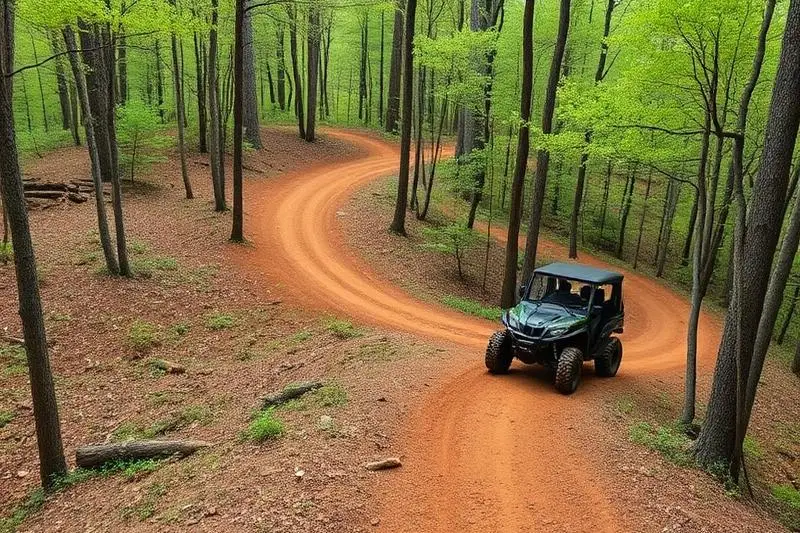
Beasley Knob
Beasley Knob is a moderate 15 miles off-road trail near Chatsworth, GA, best run Year-round. The gear list marks All-terrain tires, 4WD capability and Tow strap as required, and Skid plates as recommended. A stock high-clearance 4x4 can run it; check the gear list before you go.
Trail Conditions
No reports yet
Beasley Knob is public land, not a private park, and it is not where our record placed it. The Beasley Knob OHV Trail System is managed by the US Forest Service on the Blue Ridge Ranger District of the Chattahoochee-Oconee National Forest, located about two miles east of Blairsville, Georgia in Union County, not Chatsworth. The system provides roughly 13.4 miles of recreational driving on interconnecting dirt trails, rock hill climbs, and gravel roads, with a rock garden obstacle as the named technical feature. The reason it matters out of proportion to its size is access: this is the only trail system on Georgia public land that supports full-size vehicles wider than 50 inches. UTVs, ATVs, and motorcycles are welcome too, and spark arrestors are required for all machines. Our old note that no permit is required was wrong. A digital day pass or annual pass is required for every operator, and the Forest Service describes the system as challenging rather than moderate, which matches the difficult to most difficult ratings other sources give individual segments. Non-agency sources name specific segments including Ross Ridge, Blue Rock, and Nicholson Gap, though the Forest Service page treats the network as a single named system. Two closures shape trip planning. The area is closed seasonally from January 1 to April 1 each year, and it also closes temporarily during wet weather to prevent trail damage, which in north Georgia can mean a closure with little notice after a heavy rain. Facilities are minimal: a primitive parking area with vault toilets and no on-site camping, so plan to camp elsewhere in the Chattahoochee or stay in Blairsville. Check the Blue Ridge Ranger District page for current status before you tow up, and buy the pass before you arrive.
Fun Facts
Beasley Knob is the only trail system on Georgia public land that supports full-size vehicles wider than 50 inches.
The system offers about 13.4 miles of driving on interconnecting dirt trails, rock climbs, and gravel roads.
It sits about two miles east of Blairsville in Union County, on the Blue Ridge Ranger District.
🛞 Tires
⚙️ Drivetrain
🪢 Recovery
🛡️ Protection
Closest campgrounds to Beasley Knob:
- Lake Conasauga Overflow Campground · Chatsworth · 9 mi (straight-line)
- Lake Conasauga Campground · Chatsworth · 9 mi (straight-line)
- Hickey Gap Campground · 10 mi (straight-line)
- Woodring Branch Primitive Campground · Chatsworth · 12 mi (straight-line)
- Woodring Branch Campground · Oakman · 13 mi (straight-line)
- Doll Mountain Campground · Oakman · 13 mi (straight-line)
Straight-line distance. Check the map for drive time.
GPS Coordinates
Import into Gaia GPS, OnX Offroad, or Garmin
Map of Chatsworth, GA
5-Day Forecast
Nearby Trails
WHAT YOU'LL NEED
A mild lift, all-terrain tires, and correct gear ratio will get you through this trail confidently.
Tire Size Calculator
Convert tire sizes and compare diameter differences before you swap.
Size up correctly, 33s vs 35s matters on moderate terrain.
Gear Ratio Calculator
Find the right gear ratio after lifting or upsizing tires.
Re-gear after a tire upgrade to restore trail torque and MPG.
Wheel Fitment Calculator
Calculate backspacing and offset so wider wheels clear your suspension.
Extra wheel width = extra clearance on tight lines. Check offset before buying.
MPG Calculator
Estimate fuel economy after a tire upgrade, important for remote runs.
Bigger tires cut MPG. Plan your fuel stops for this trail.