Rio Grande Gorge Backcountry
Rio Grande Gorge Backcountry is a moderate 60+ miles off-road trail near Taos, NM, best run April - November. The gear list marks All-terrain tires as required, and 4WD recommended and Tow strap as recommended. A stock high-clearance 4x4 can run it; check the gear list before you go.
Trail Conditions
No reports yet
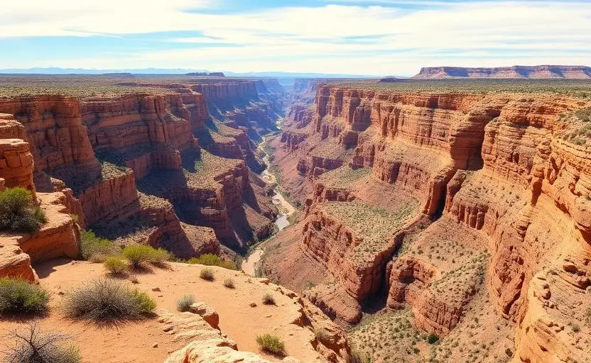
The Rio Grande Gorge Backcountry follows the rim of one of the most dramatic geological features in the Southwest. The 800-foot-deep volcanic chasm cuts through the high desert sage plain north of Taos, accessible by a network of dirt roads that lead to remote overlooks and river access points.
Fun Facts
The Rio Grande Gorge Bridge, built in 1965, spans 650 feet above the river.
The gorge was carved by the Rio Grande through volcanic basalt over millions of years.
Taos Pueblo has been continuously inhabited for over 1,000 years.
The Taos Hum, a mysterious low-frequency sound, has been reported by residents since the 1990s.
🛞 Tires
🔧 Suspension
⚙️ Drivetrain
🪢 Recovery
Closest campgrounds to Rio Grande Gorge Backcountry:
- Taos RV Park · Ranchos de Taos · 10 mi (straight-line)
- Taos Valley RV Park & Campground · Taos · 10 mi (straight-line)
- Sierra Village RV Park · Taos · 10 mi (straight-line)
- Questa Lodge · Questa · 18 mi (straight-line)
- Twining Campground · 19 mi (straight-line)
- Columbine Campground · 20 mi (straight-line)
Straight-line distance. Check the map for drive time.
GPS Coordinates
Import into Gaia GPS, OnX Offroad, or Garmin
Map of Taos, NM
5-Day Forecast
Nearby Trails
WHAT YOU'LL NEED
A mild lift, all-terrain tires, and correct gear ratio will get you through this trail confidently.
Tire Size Calculator
Convert tire sizes and compare diameter differences before you swap.
Size up correctly, 33s vs 35s matters on moderate terrain.
Gear Ratio Calculator
Find the right gear ratio after lifting or upsizing tires.
Re-gear after a tire upgrade to restore trail torque and MPG.
Wheel Fitment Calculator
Calculate backspacing and offset so wider wheels clear your suspension.
Extra wheel width = extra clearance on tight lines. Check offset before buying.
MPG Calculator
Estimate fuel economy after a tire upgrade, important for remote runs.
Bigger tires cut MPG. Plan your fuel stops for this trail.