Rubicon Trail
The Rubicon Trail is 22 miles long, running from the Georgetown side of El Dorado County to Lake Tahoe. It is rated Expert: plan 2 to 3 days, and bring a built rig: front and rear lockers, 35-inch or larger tires, a 3-inch or taller lift with re-geared axles, armor and a winch. Our best-season window is July to October.
Trail Conditions
No reports yet
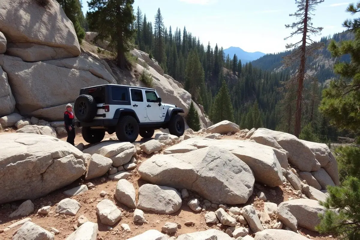
The Rubicon Trail runs about 22 miles from Georgetown to Lake Tahoe, California, and is best run July to October. Most runs start at the Loon Lake trailhead, about 12 miles from Lake Tahoe. Descending to the historic Rubicon Springs, the trail winds through ancient glacier-carved terrain featuring massive granite boulders, steep ledges, and narrow passages that require precise wheel placement. The trail's legendary obstacles like Cadillac Hill, Big Sluice, and Walker Hill have broken countless vehicles and created lifelong memories. Rubicon Springs, roughly midway through the trail, offers a peaceful camping area with natural hot springs where wheelers have gathered for over 70 years.
Rubicon Trail Length, Drive Time and Difficulty
Length: about 22 miles from Georgetown to Lake Tahoe, or about 12 miles from the Loon Lake trailhead to Lake Tahoe, per El Dorado County.
Drive time: plan for 2 to 3 days minimum to complete the trail safely.
Difficulty: Expert. Season: July to October.
Fun Facts
The Rubicon Trail has been used since the 1880s, originally as a cattle drive route.
The annual Jeepers Jamboree, started in 1953, is the oldest organized off-road event in the world.
The trail crosses both El Dorado and Placer counties at elevations up to 7,800 feet.
Cadillac Hill got its name after a 1950s Cadillac was abandoned there after breaking down.
Know before you go
- Campfire permits are required for any open fire. Get one from any Forest Service, CAL FIRE or BLM office in California, or online through Ready for Wildfire. You must be 18 or older to sign it.
- El Dorado County posts current-season Rubicon Trail Site Assessment Reports. Read the latest one before you go.
- Who to call: El Dorado County Parks and Trails, 530-621-5360. Georgetown Ranger Station, 530-333-4312. Lake Tahoe Basin Management Unit, 530-543-2600.
- Non-street-legal vehicles: California State Parks' OHMVR Division handles OHV registration and permits for out-of-state visitors.
🛞 Tires
🔧 Suspension
⚙️ Drivetrain
🪢 Recovery
🛡️ Protection
📦 Other
Closest campgrounds to Rubicon Trail:
- Loon Lake Campground · 5 mi (straight-line)
- Meeks Bay Resort Campground · Tahoma · 7 mi (straight-line)
- Sugar Pine Point State Park Campground · Tahoma · 7 mi (straight-line)
- Airport Flat Campground · 8 mi (straight-line)
- Kaspian Campground · 8 mi (straight-line)
- Gerle Creek Campground · 8 mi (straight-line)
Straight-line distance. Check the map for drive time.
GPS Coordinates
Import into Gaia GPS, OnX Offroad, or Garmin
Map of Lake Tahoe, CA
5-Day Forecast
Nearby Trails
WHAT YOU'LL NEED
Expert-level terrain demands a purpose-built rig. Use every tool here before committing.
Tire Size Calculator
Convert tire sizes and compare diameter differences before you swap.
Running 35s or 37s? Confirm fitment and sidewall height before you go.
Gear Ratio Calculator
Find the right gear ratio after lifting or upsizing tires.
Low-range crawl ratio is everything on technical terrain, calculate yours first.
Wheel Fitment Calculator
Calculate backspacing and offset so wider wheels clear your suspension.
Extra wheel width = extra clearance on tight lines. Check offset before buying.
MPG Calculator
Estimate fuel economy after a tire upgrade, important for remote runs.
Remote Expert trails have no fuel stops. Know your range before you leave.
Trail Matchmaker
Not sure this trail matches your rig's current build? Find out fast.
Answer 6 questions and confirm Rubicon Trail is right for your setup, or find a better match.
Frequently Asked Questions
Sources: El Dorado County: Rubicon Trail. Facts checked October 11, 2026 by Abe Choe.